We made landfall in the Bahamas on Friday, March 6. For the story, check out our blog: Sailing on Windsong II.


We made landfall in the Bahamas on Friday, March 6. For the story, check out our blog: Sailing on Windsong II.

Now that I’ve settled back into the swing of things in my Canadian home, I’ve been compiling a long list of photographic projects I would love to accomplish before we go away again. (What would I do without lists?) This includes making prints, making books, and making a video from my Bahamas images, as well as reorganizing my portfolio and streamlining my blog. I also have ideas for several series I would like to start shooting and have identified some new techniques I would like to learn. I’ve noticed that I’ve been moving more toward 500 px and away from Flickr lately, although I still pop in at Flickr intermittently. I’ve found that 500 px has so much more functionality for me, especially since it acts as the back end of my portfolio. It is so easy and pleasant to use, plus I enjoy the quality of the photography there. This week I uploaded a few images from my winter sailing experience to 500 px and have been surprised and gratified by the positive feedback. I encourage you to have a look at 500 px if you’re seeking an easy way to set up a portfolio or you would like to sell or license your work. And if you’re already a member of 500 px, let me know and I’d be pleased to follow your work. Enjoy your weekend, everybody!


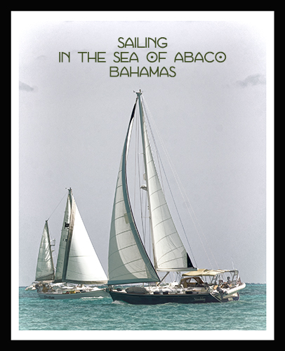
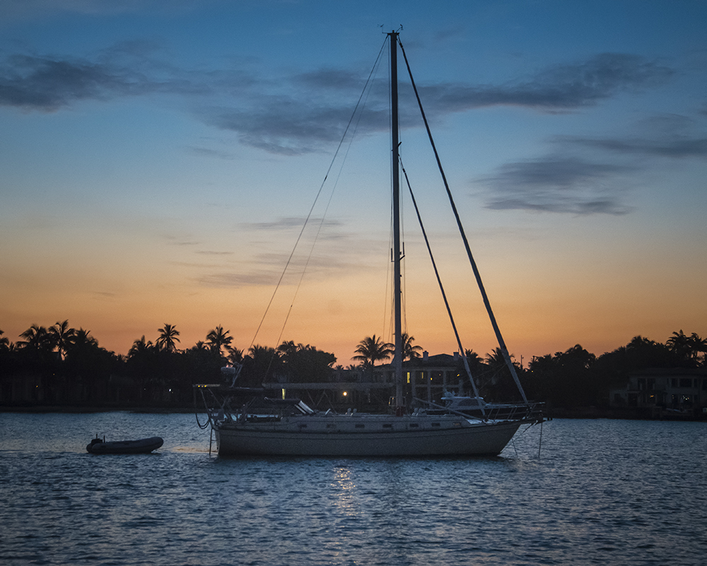
The Sea of Abaco in a tranquil moment, as seen from our sailboat Windsong II.

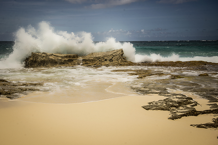
Great Guana Cay has a seven mile beach and the island is not more than 400 yards wide at any point. The barrier reef makes for amazing snorkeling and diving.
We’re still leaving and heading back to Florida — really! — we’re not just trying to find excuses to stay here…
But our crossing has been delayed and so has our departure. So we took the opportunity to head over to Great Guana Cay with Mike and Keith and Bobbie for a bite of lunch at the famous Nipper’s.
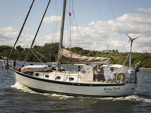
We sailed over on Mike’s boat the Casey Dee. The voyage took about two hours each way and at one point I was below and Bob was at the helm.
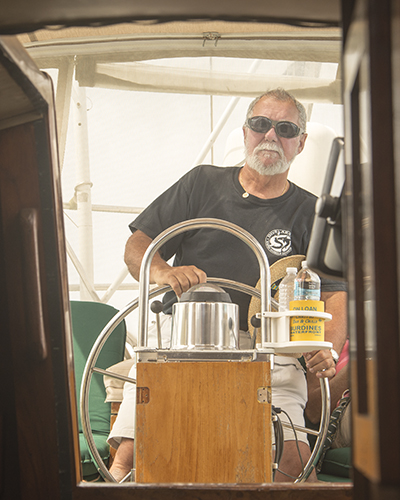
Mike has a 33-foot Alajuela and it is a great salty boat, which Mike has been singlehanding for many years. He is amazing to watch…his ease and calm come from all his experience and training as a licensed captain.
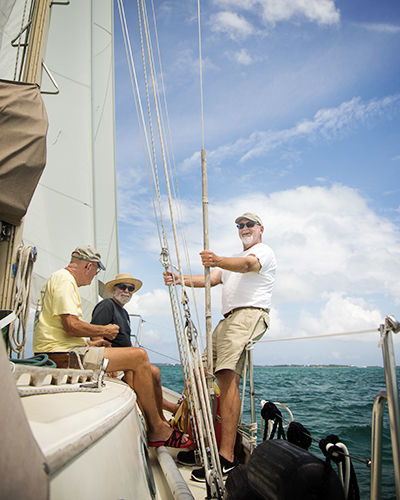
At one point the auto pilot took over and Mike and Keith and Bob were on the bow and Bobbie and I and Charles were chatting in the cockpit. It was a lovely sail at 5 knots with just the jib. Winds were 15 to 20 knots from the north.
At Nipper’s — Thanks to Mike for taking pics of me and Bob together. I’ve trained him up on my back button focus and he does and great job!
While walking on the beach, Bob took Charles off the leash just at the time that a little white poodle showed up. Charles took a fancy to her and raced off and up the steep wooden staircase with Bob in hot pursuit. What a little devil he can be. After that he was tired so he just laid under the table while we ate (Charles, not Bob!)
Oh, it’s mighty hard to leave this beautiful part of the world.
Happy Easter to all of our family and friends!


We headed over to Man o’ War Cay the other day to drop off our jib for repair. It was a 50 minute ferry ride from Marsh Harbour. We stayed for the rest of the day to explore the cay and have lunch.
The history of Man o’ War Cay began with a shipwreck and a love story. In 1820 16-year-old Benjamin Albury found himself shipwrecked on the cay. He fell in love with Nellie Archer, whose parents had settled there to farm in 1798.
They married and today the name Albury is everywhere, from on the ferry line to boat-building to a popular canvas bag-making enterprise.
Boat-building began in the 1880’s and today Man o’ War Cay is home to self-sufficient and resilient residents who are proud of their island and their boat-building heritage.
We loved this little unspoiled cay and here is just a brief taste of what Bob, Charles and I enjoyed recently. (You may notice a certain colour story going on here…I can’t seem to get away from it, but nor do I want to!)

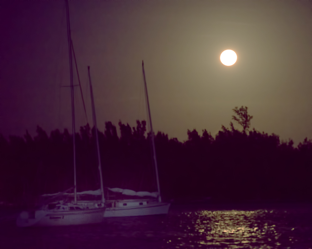
Moon over Marsh Harbour
When we arrived here in Marsh Harbour, we anchored out in the harbour for a few days while waiting for a slip. Then when a slip became available in the marina, we moved in there. It’s romantic out there on the hook but a bit of a pain to dinghy Charles in in rough weather, schlep our water out and also run the generator every day to supply our electricity. In the slip we have lots of power, water, and Charles has easy access to land. We can also get four TV channels! As we’ve mentioned before the only real downside is poor Internet access. Other than that we are in heaven.
Marsh Harbour is a large protected harbour in the Abacos where many cruisers spend the winter. There is a wide choice of marinas and restaurants and tons of charter activity. Catamarans are a popular rental vessel.
The marina we are in has a good restaurant called the Jib Room which also serves as a cruiser’s lounge. We’ve eaten here quite a bit and really enjoyed it. Lots of fish options for me. The house drink is a “bilge burner” which goes down so easy you can get into trouble very quickly if you don’t watch it.
We dinghy across the harbour to do our groceries and shopping. There is an amazing grocery store called Maxwell’s which provides the best shopping outside of Nassau. In fact we have to go there in a few minutes to get some coffee.
Marsh Harbour is centrally located to allow day trips to many of the popular cays around. This week we took a ferry to Man o’ War to drop off our jib sail for repair. Pics of that trip to come…

View of marina from next door

Nice little beach down the street…


Part III — March 11 to 15, 2014
After a fabulous day sailing, we arrived at Greet Turtle Cay at 5:00 pm. We had radioed ahead for a slip at the Green Turtle Club. As we made our way into White Sound Harbour we got a little close to shore because the rough weather had moved some channel markers.
We were all very happy to get our feet on dry land again, especially Charles! I jumped off the boat with him to take him to shore and he was super relieved about the whole business, if you know what I mean. The humans were all eager for a cold drink and a shower and a good meal. After getting settled in and having a tour of the beautiful marina and popular dining room and bar, Bob BBQ’d up some T-bone steaks for the two boys and they totally enjoyed them with fried onions, baked potatoes and corn. We hit the sack at 9:00 pm since we were still catching up on our sleep.
The winds forecast for the next two days were 35 knots so we were happy to be in a snug harbour. We chose to be in a slip since it is quite a challenge to be anchoring out and dinghying Charles back and forth in bad weather.
So we took this opportunity to see a little of Green Turtle Cay. Mike, who was at another marina down the way, came over and we all piled into a golf cart to do a tour of the island. New Plymouth, the settlement, is on the southern tip of the mile long island, which is home to only 500 residents. Most are descended from Loyalists to Great Britain.


Pineapples — a cute quiet spot by the water…

After checking out a few secluded beaches, we headed to the Leeward Marina for a delicious fresh fish lunch with Mike and then toured around New Plymouth after lunch stopping to get some special Bahamian rum for $9 in the liquor store.
We left the road and Mike directed us through bumpy jungle trails to a charming spot by the water called Pineapples that held many great cruising memories for him. We enjoyed a rum punch there and then headed back to the marina to check the weather. This was my first opportunity since we left to check emails, check weather sites and get a post or two up, so I tried to take advantage of it.
In the next leg of our journey we were headed to Marsh Harbour and we needed to go through the Whale Cay Passage to do so. What this means is that we would have to leave the Little Bahamas Banks through a cut and go into the deep ocean waters for about three nautical miles and then come back in and continue our journey on the Banks until we reached our destination.
The Whale Cay Passage is infamous for the danger it can present to boaters about 20% of the time. It has caused more lives and vessels lost than all other areas in the Bahamas combined. You have to treat it with great respect.
You have to watch the weather and tides carefully and listen for reports of others who are going through in order to make an informed decision about whether to pass through on any particular day.
Over time, 20 mph winds from the North, Northeast or East can produce swells that make the Whale dangerous. Once the winds have been blowing for a day or two from any of those directions and then abate, it can still take a day or so for the wave action to settle. This is called a “rage”. From a distance, using binoculars, a rage looks like elephants dancing on the horizon. A rage is obviously not a good time to cross the Whale.
Every day all four of us would look at weather reports, talk to others and evaluate what would be a good day to go through the Whale. We were prepared to stay a week if necessary but we were hoping to push on sooner. From these discussions it appeared that Saturday morning would offer a weather window and high tides to transit the Whale.
We got up at 6:00 am, checked out at 7:00 am and were out of the harbour at 8:00 am where we rendezvous’d with Mike. High tide was 8:35 am.

As we enter the Whale Channel, Leo keeps his eye out for elephants!
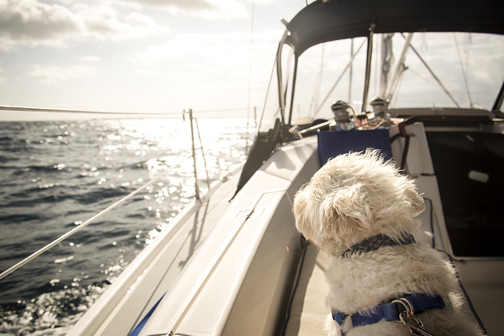
Charles is serene as we approach the Whale.

This is the GPS screen on our plotter showing our route through the Whale Cay passage.
A motor vessel, Rambler, which we had met in the Green Turtle Marina, was about two miles ahead of us entering the Whale. He radioed back as we proceeded and indicated a favourable passage.
He was right. The wind was less than 10 knots from the southeast. The waves in the Whale were 2 to 3 feet so conditions were very good. It was a smooth and comfortable passage. When we got out into the ocean, the waves were bigger (4 to 6 feet) but with a dominant period of 42 seconds, it was rolly but not unpleasant. I managed to get some pictures and take some video of Mike in the Casey Dee.

Part II — March 11 and 12, 2014
Once we left West End the first order of business was to get through Indian Cut, a shallow and narrow 10 mile channel in the reef that would allow us to reach the protected waters of the Little Bahamas Banks.
As we approached the channel, the water depth went from 30 feet to 9 feet. We sounded our way through it trying to find the deepest water. That was often only 6 feet deep and we need at least 5 feet to pass through without going aground.

Bob was watching the colour of the water as he steered manually from waypoint to waypoint. Leo and I called out the depths from the depth sounder as we progressed.
It was hard not to be distracted by the clarity and colour of the water since it is very unusual to be anywhere in a sailboat and be able to see the bottom. Our friend Mike had promised “gin clear” waters and they were.
Once we got through the reef Leo took control of the boat and Bob fell asleep in the cockpit, staying nearby in case we needed him. He went out like a light and slept a good two hours. We were trying to make Great Sale Cay by dark.

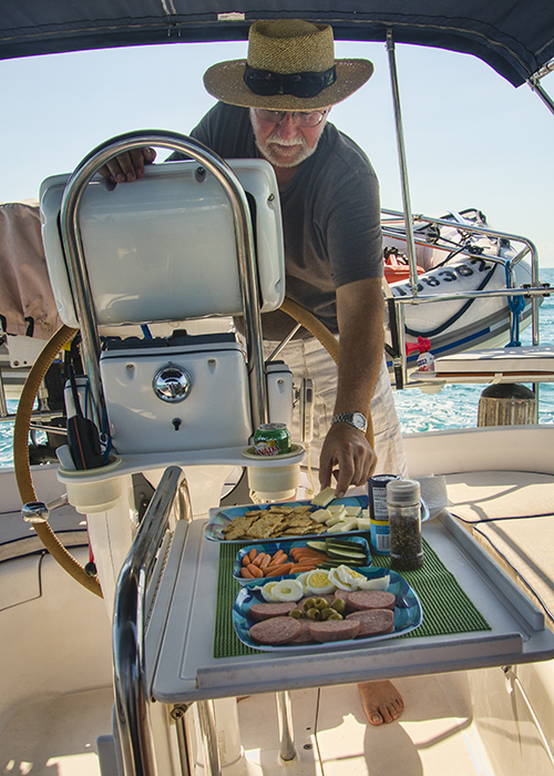
Leo and I took turns having snoozes later. At about 4:00 pm, we were all ravenous. It was lovely and calm so I laid out some cheese, crackers, sausage, veggies, hard-boiled eggs and olives in the cockpit to take the edge off our appetites.
Once on the Banks, the water depth varied from 9 to 12 feet. In the mid afternoon, Leo and Bob set two lures out behind the boat. We were moving a bit too fast for fishing but they thought, “what the heck, why not give it a try?”

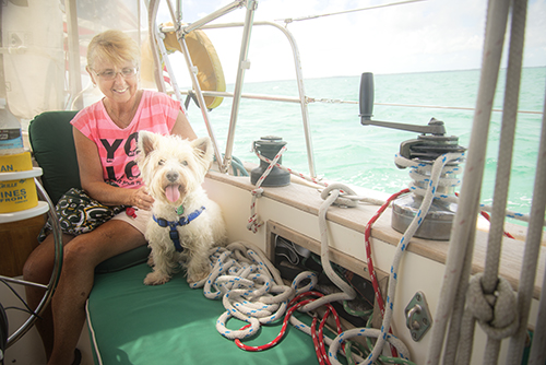
We arrived in the anchorage at Great Sale just as the sun was setting. We were the last in — there were already 10 boats there when we got there. We set the anchor and launched the dinghy in the dark. Charles was quickly loaded to go ashore for a bathroom break. It was starting to blow about 18 knots. The shore was rough with coral, and with the surf it would have destroyed our dinghy in 10 minutes had Bob landed the boat. So he had to turn around and come back to Windsong II. We felt so badly for poor Charles, he had been a great boy all day. We tried to convince him to go on the boat but he would not go. He seemed to understand the problem. He has gone on the boat before, so we knew he could do it.
We used the propane BBQ on the back of our boat to make hamburgers for the guys. (I had a salad and veggies since I’m no longer eating meat.) After dinner we collapsed in our bunks — we were so tired from lack of sleep and being out in the sun and wind for so long. The water was a bit lumpy that night but nothing was going to interfere with our sleep that night.
The wind began to pick up again before dawn on Wednesday morning. We were all up at daybreak. Mike called on the radio, itching to go, because bad weather was coming. We had to leave without taking Charles ashore.
The weather forecast called for two days of high winds. The closest harbour that would provide protection was Green Turtle Cay, about 50 nautical miles away. We needed to get there before dark.
We were travelling in an easterly direction over the banks with a strong south wind, so the wind was on our beam, the best point of sail. We motored for a while and then pulled out our jib. The boat stood up and took off. The winds were 22 to 28 knots.. Our boat has a maximum hull speed of 7.1 knots, but we were surfing down waves at 8.5 knots. It was an amazing sail — we all had wide grins. Leo, our resident speed demon, took great pleasure in calling out our speed as we went along.

We motorsailed like that almost all day. When the gusts got bigger in the late afternoon, we reduced the sail size a bit, but not enough, so we blew the leach line out of our sail. What that means is that the stitching on the seam along the back of the sail let go. This was probably due to sun damage over 10 years since the jib was original to the boat.
Bob could fix something like this with his special Sailrite sewing machine, which unfortunately is in the truck back in Florida. (Next time we will know better and bring it with us!) However there is a sail maker nearby on Man o War Cay. We will bring it by and have it fixed by him.
It was another long day and we made it to Green Turtle Cay.
Next instalment: waiting out the weather in Green Turtle Cay.
Note to my fellow bloggers: I deeply regret that I’m not able follow your adventures and blogs right now and send you my comments. Our Internet service is so limited and unpredictable that I have only been able to publish a few blog posts and send a few emails. I’ve managed a few “likes” on Facebook but that’s about it. But know I am thinking of you and I so appreciate all your kind comments. When we get back to Florida, I will so look forward to catching up with all your posts and images. It will be like gorge fest for me!

Part I – March 9, am to March 11 am, 2014
After several months of waiting for our new mast and making preparations, we left Mariner Cay Marina Sunday morning (March 9, 2014) at 9 am, having bid farewell to all our friends the day before. We had hoped to sail to Palm Beach inlet in the ocean, but because of strong north winds against the Gulf Stream we decided to go south through the ICW (the Intracoastal waterway). This is a trip of some 45 nautical miles.

Charles takes his last walk for the season
On board Windsong II were Bob, Sherry and Charles. Bob’s brother Leo, who has many years of boating experience, would be additional crew as far as Marsh Harbour in the Bahamas. He’d fly back from there in order to prepare for his upcoming trip to China.
We travelled with our buddy boat Casey Dee, which is captained by our friend Mike, an experienced sailor who hails from Iowa and has crossed to the Bahamas at least 10 times before. It’s always a good idea to go across the Gulf Stream with one or more buddy boats.
Both of us were destined for Marsh Harbour on Great Abaco Island in the Bahamas. The entire voyage would be about 250 nautical miles. Motoring at an average speed, it would take us four days. To put it in perspective, if you left from Florida on a plane, you could be in Marsh Harbour in an hour and a half. We live life in the slow lane!
All went well down the ICW or “the ditch” until we got to our first lift bridge in Hobe Sound, which was a bridge that opened “on demand.” We called the bridge tender on our VHF radio requesting an opening so we could pass through. After about a 15 minute wait the bridge tender explained that there was a mechanical failure and he had called maintenance to come and fix it. We had approached the bridge with our buddy boat Casey Dee, as well as a Hunter 32 and a large motor cruiser.
We began to circle around. Mike, with more experience, immediately and intentionally ran his boat aground in the soft mud and went down below to make a bite to eat. We began motoring back and forth with the other two boats for the next hour.

Bob runs the flags up the halyard as we start down the ICW…
Mike waves to us from the Casey Dee…
The ICW is pretty narrow in places…you get pretty close to the houses…
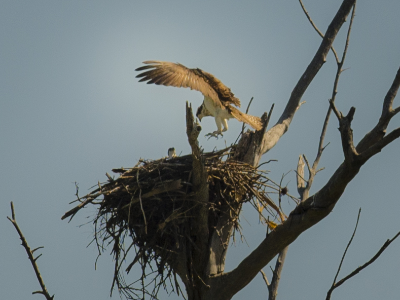
Sighting an eagle landing…
Suddenly the bridge tender radioed: “Bring em up, we’re opening the bridge!” Bob pulled a sharp turn and we watched the depth sounder go from 8.5 to 4.5 feet and we stopped dead as the other boats rushed to queue up for the opening. Our keel is 5 feet. We were aground. Not the best timing!
I moved to the starboard side of the boat and called to Leo to join me. This tilted the boat over a little and Bob opened the throttle for the engine. Slowly we plowed the keel through the soft mud in time to follow the parade of boats through the bridge.Fortunately, the next six or so bridges we had to go through all opened without incident.
We planned to anchor near the Palm Beach inlet so we could be close to U.S. customs in order to process the paperwork we needed prior to leaving U.S. waters. We would depart the U.S. through the inlet the next day.
As we passed Peanut Island, we were accosted by sight of several thousand spring breakers in bathing suits with their small power boats stacked ten deep in the shallow waters next to the island, a popular recreation spot. Many were standing on the sand bars beside their boats drinking from paper cups, shrieking and listening to loud music. It turns out that you cannot be charged for under age drinking if you are not on dry land or in a boat. This was a legal loophole that the “youngsters” were taking full advantage of!
We anchored right next to the northern tip of the island of the “rich and famous” called Palm Beach. That night and the next morning we watched as huge cruise ships entered the inlet from the Bahamas and went right past us. On Monday we took care of our customs business and gave Charles a good long walk on Peanut Island.
Anchored out near Palm Beach

Cruise ships come in and out the Palm Beach Inlet
The time to cross the Gulf Stream was fast approaching.
Our destination was West End in the Bahamas, almost due east, 55 nautical miles away. In between us and West End lay the Gulf Stream. The Gulf Stream is an ocean river, which flows from the Gulf of Mexico along the east coast of North America to Europe. Between Florida and the Bahamas, the water depth changes very quickly from 20 feet to thousands of feet deep. So the volume of water is forced through this canyon. Wind acting on this water flow can produce very dangerous conditions for smaller boats.
We usually cruise at 5.5 knots. The centre of the Gulf Stream moves at 4 knots in a northerly direction. Imagine trying to walk across a street that is a conveyer belt and which moves almost as fast as you can walk. In order to cross the street directly, you can’t do it in a straight line.
We talked to lots of experienced crossers and read up on all the advice offered on strategies for crossing the Gulf Stream. Our plan was to navigate the boat to a point about 15 degrees south of West End. By combining our speed going east with the Gulf Stream speed going north, after 11 or 12 hours, we should have West End in sight.
It’s important to arrive in the Bahamas in daylight because the navigation charts require that you’re able to see where you’re going (This is called visual piloting rules.) Sailboats going from Florida to the Bahamas usually have about a 12 hour journey. Most usually leave in the middle of the night.
We decided to leave Florida at 5:30 pm on Monday afternoon. Since this was our first trip we wanted to see for ourselves that the weather reports that we had been glued to for days were actually correct. As newbies, we wanted to be able to go out on the ocean in daylight, check out the weather a couple of miles offshore and still have time to come back to the anchorage by dusk if the seas were too choppy.
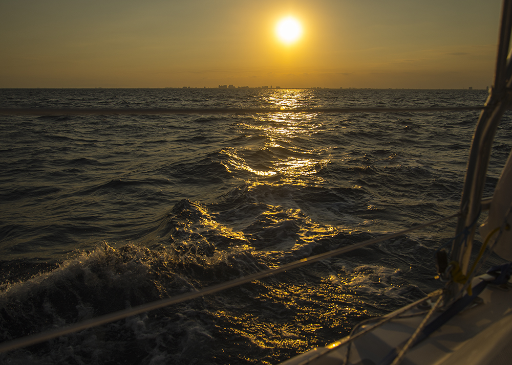
All reports said we had an ideal weather forecast for our crossing. It was quite beautiful leaving Florida. As we went out the inlet, Tiger Woods’ megayacht “Privacy” was just coming in. He didn’t recognize us. We watched the sun set over the coastline and the seas were smooth and calm as we left the mainland.

Passing Tiger Woods boat on the way out…
Leaving Florida…
Our colour digital radar allowed us to see the cruise ships and cargo vessels around us. On one occasion we altered our course to be sure we would pass behind one.
At night it can be very difficult to see exactly how far away things are and sometimes what direction they are moving. We could also see Mike in his boat because of his Big Blipper radar reflector. We did not cruise really close together but we did stay in radio contact, and could usually see him on our radar. It was a beautiful moonlit night, waves were about 2 to 3 feet with light winds just as forecast. We were amazed how much we could see on the water in the moonlight.
About midnight the sky started to cloud over a bit and the wind came up some causing some bigger waves, but nothing to get excited about. Mike radioed he had put his sails up and was having a ball. We decided to just keep motoring as we were making better time than expected and it seemed that might get in to West End ahead of schedule.
By 1:30 am we were in near gale force winds of 28 knots with gusts to 35. We kept in close radio contact with Mike, who was having some challenges getting his sails down. The winds were behind us causing some large breaking waves around us. The moon had disappeared and we could not see much of anything; we were just crashing along through the dark, watching the radar screen.
But Windsong II was taking good care of us and was handling it well. We never felt we were in trouble or the boat was being overwhelmed. We were all in the cockpit for the whole time, including Charles, who slept through the entire experience.
It was a bit disturbing not being able to see the waves coming, each one seemed on a slightly different angle to the stern of the boat, all moving much faster than we were, as they broke they growled and the boat heaved one way or the other, rolling as the waves passed under us.
By playing with the autopilot and Leo’s keen observations Bob was able to get a direction that minimized the discomfort, allowed the boat to settle down a bit and the autopilot was able to do a better job. We cannot imagine not doing this trip without an autopilot. It was not really the direction we wanted to go but it was close enough.
No one got seasick, thank goodness. I took a mild seasickness pill as a precaution and we drank some gingerale along the way, but we really had no problems at all.
We approached West End at about 4 am in the pitch black, quite a bit earlier than expected. We could see lights but could not see the shoreline at all. You know that old saw about it always being darkest before the dawn. Well, that was certainly our experience. My eyes started playing tricks on me and I imagined all sorts of weird and wonderful things out there in the ocean.
The radar allowed us to see things. In fact as we were crossing Bob could see West End from about 40 miles away on the radar.
For safety reasons we chose to motor around outside the entrance to West End until daylight. We had plenty of fuel. The winds continued at 25 to 35 knots with big breaking waves. We used the autopilot and tried to pick the best directions for our comfort without getting too far away from our final objective.
Finally at about 7:30 am there was enough light to see, so we turned to approach the entrance to the channel. We could now clearly see the opening in the breakwater. We had no problems getting in with the light of day. It would have been truly impossible at night.
We tied the boats to the government dock at the customs office, exhausted. We had gone 24 hours straight without sleep.
Bob ran a yellow flag up the flag halyard — this stands for the letter Q. We were under quarantine until cleared. We started cleaning up stuff and trying to tidy up a bit in case we were inspected by customs.
 The customs office opened at 9 am and we went in. There were eight long forms to complete including things like a ship’s inventory, a health form swearing we were not aware of any plague, cholera, etc. on board, that we had no infected rats on board and all crew and passengers were in good health. These forms were obviously developed many years ago and were still in use!
Bob and I filled in the forms together. At this point he could hardly think straight. After an hour or so we walked out with our cruising permit for the boat and all our passports stamped.
Understandably, Charles was anxious to get off the boat and relieve himself. We were pretty hungry so we headed to a beachside restaurant at the Old Bahamas Bay resort where we devoured large veggie omelettes and downed copious cups of coffee.
By about 11 am we had topped up our fuel tanks and were back on the boat. The next leg of the journey would take us to Great Sale Cay, where we would anchor in the lee of the island.
Stay tuned for more…

